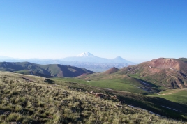
Armenian highlands
Thursday, January 13, 2022
The Armenian highlands is the most central and the highest of the three plateaus that together form the northern sector of Western Asia.
Clockwise starting from the west, the Armenian highlands are bounded by the Anatolian plateau, the Caucasus, the Kura-Aras lowlands, the Iranian Plateau, and Mesopotamia. The highlands are divided into western and eastern regions, defined by the Ararat Valley where Mount Ararat is located. Western Armenia is nowadays referred to as eastern Anatolia, and Eastern Armenia as the Lesser Caucasus or Caucasus Minor, and historically as the Anti-Caucasus, meaning "opposite the Caucasus".
During the Iron Age, the region was known by variations of the name Ararat. Later, the Highlands were known as Armenia Major, a central region to the history of Armenians, and one of the four geopolitical regions associated with Armenians, the other three being Armenia Minor, Sophene, and Commagene.
The population of the region has been primarily Armenian for most of its known history. Prior to the appearance of nominally Armenian people in historical records, historians have hypothesized that the region must have been home to various ethnic groups who became homogenous when the Armenian language came to prominence. The population of the Armenian Highlands seem to have had a high level of regional genetic continuity for over 6,000 years. Recent studies have shown that the Armenian people are indigenous to the Armenian Highlands and form a distinct genetic isolate in the region. The region was also inhabited during Antiquity by minorities such as Assyrians, Georgians, Greeks, Jews, and Iranians. During the Middle Ages, Arabs and particularly Turkmens and Kurds settled in large numbers in the Armenian Highlands. The Christian population of the western half of the region was exterminated during the Armenian genocide of 1915. Today, the eastern half is mainly inhabited by Armenians, Azerbaijanis and Georgians, while the western half is mainly inhabited by Kurds (including Yazidis), Turks, Azerbaijanis, Armenians (included crypto-Armenians and Hemshins) and Zazas.
The region was administered for most of its known history by Armenian nobility and states, whether it was as part of a fully independent Armenian state, as vassals, or as part of a foreign state. Since the 1040s, the highlands have been under the rule of various Turkic peoples and the Safavid dynasty, with pockets of Armenian autonomy in places such as Artsakh. Much of Eastern Armenia, which had been ruled by the Safavids from the 16th century, became part of the Russian Empire in 1828 and was later incorporated into the Soviet Union, while much of Western Armenia was under the rule of the Ottoman Empire and later incorporated into Turkey. Today, the region is divided between Turkey, Georgia, Armenia, Azerbaijan and Iran.
Geography
The Armenian Highlands is part of the Alpide belt, forming part of the Asian range that stretches from the Pontic Mountains to the Malay Peninsula. Its total area is about 400,000 km2.Historically, the Armenian Highlands have been the scene of great volcanic activity.[10] Geologically recent volcanism on the area has resulted in large volcanic formations and a series of massifs and tectonic movement has formed the three largest lakes in the Highlands; Lake Sevan, Lake Van and Lake Urmia. The Armenian Highlands are rich in water resources.
The central, axial chain of Armenian highland ridges, running from west to east across Western Armenia, is called the Anti-Taurus. In the west, the Anti-Taurus departs to the north from the Central (Cilician) Taurus, and, passing right in the middle of the Armenian plateau, parallel to the Eastern (Armenian) Taurus, ends in the east at the Ararat peaks.
To the west is the Anatolian plateau, which rises slowly from the lowland coast of the Aegean Sea and converges with the Armenian Highlands to the east of Cappadocia. The Caucasus extends to the northeast of the Armenian Highlands, with the Kura river forming its eastern boundary in the Kura-Aras lowlands. To its southeast is the Iranian plateau, where the elevation drops rapidly by about 600 metres (2,000 ft) to 1,500 metres (5,000 ft) above sea level. To the southwest is Mesopotamia (or Fertile Crescent).
Most of the Armenian Highlands is in present-day eastern Anatolia, and also includes northwestern Iran, all of Armenia, southern Georgia, and western Azerbaijan. Its northeastern parts are also known as Lesser Caucasus, which is a center of Armenian culture.


